HOME PAGE
WHAT'S NEW?
JUNIOR PAGE
COACHING
WHAT IS
ORIENTEERING?
GALLERY
MAPPED AREAS
EVENTS DIARY
RESULTS
SOLUS
CLUB POLICIES
HOW TO JOIN
LINKS
COMMENTS FORM

THE HEADLESS CHICKEN PAGES
Troston Forest
&
Shambellie Wood
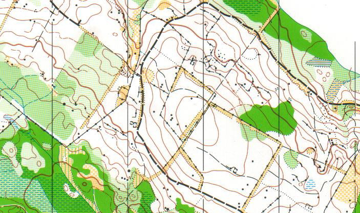
Grid Reference NX 932 696
Surveyed and mapped in 2002. Partial update 2013.
Land privately owned.
This area is to the south of Mabie Forest and is 90% forest with a variety of tree species and 10% open moor. The forest has a mixture of all grades of runnability, an abundance of rock features and good contour detail.
Tea room in New Abbey.@ Crown Copyright. All rights reserved. PU 43423U. BOF Map registration number:- SO-02-416