HOME PAGE
WHAT'S NEW?
JUNIOR PAGE
COACHING
WHAT IS
ORIENTEERING?
GALLERY
MAPPED AREAS
EVENTS DIARY
RESULTS
SOLUS
CLUB POLICIES
HOW TO JOIN
LINKS
COMMENTS FORM

THE HEADLESS CHICKEN PAGES
Dalbeattie Street Map
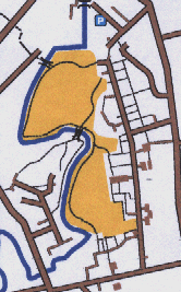
Grid Reference NX 834 617
Produced on OCAD in 1999.
This is a map of contrasts; open park land is surrounded by built up areas which are a mixture of older and more recent housing. In the older part of the town concentration has to be maintained in order that pathways which can provide short cuts are not missed. In the newer housing areas complex pathways criss-cross each other and can easily confuse the unwary. Route choice around the river area, where there are few crossing points, is critical if time penalties are to be avoided. While longer courses will be required to cross busy roads it is possible to keep the shorter courses on minor roads.