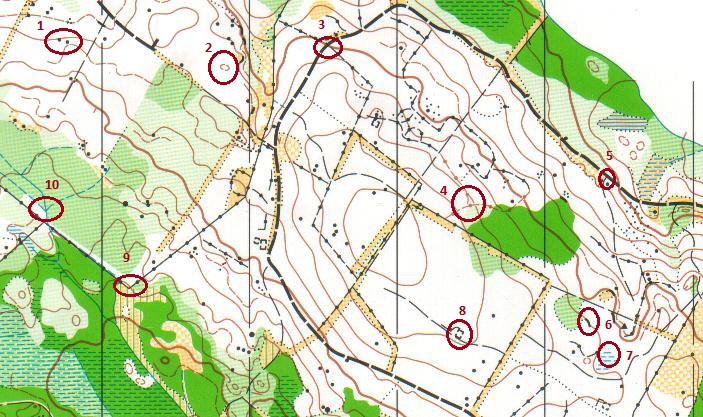
Orienteering maps are packed with lots of information. Understanding the different colours and combinations of symbols which you are likely to find on an o map
can make your orienteering experiences so much easier and more enjoyable. Look at the map section in the table below. It has ten numbered circles marked on it.
Each circle has a chioce of 3 or in some cases 4 possible descriptions in red text. Choose the phrase which you think matches that circle best then click on it to
see if you are right.
The first circle on the map is round two black dots. Click on the link which you think best describes this control site location. Cliff. Knoll or small hill. Between boulders.
The symbol in the second circle is shown in brown so you know that this feature is to do with the shape of the land. Which of the following best
descrbes this feature? Knoll or Small hill Pit. Depression.